![]()
![]()
![]()
![]()
You can view multiple geometries as an image to understand what the data in the database represents using the Spatial Viewer.
Prerequisites
Permissions to select from the table containing the spatial data.
Context and remarks
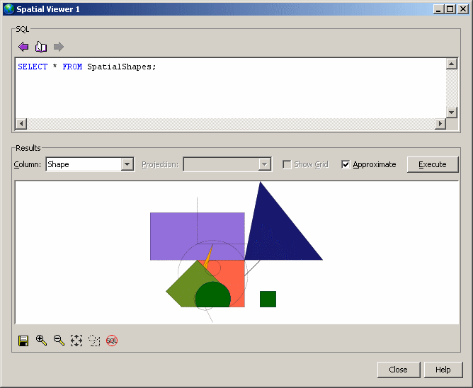
The order of rows in a result matter to how the image appears in the Spatial Viewer because the image is drawn in the order in which the rows are processed, with the most recent appearing on the top. Shapes that occur later in a result set can obscure ones that occur earlier in the result set.
 View spatial data as images (Spatial Viewer)
Connect to your database in Interactive SQL, click Tools » Spatial Viewer.
In the Spatial Viewer, execute a query similar to the following in the SQL pane and then click Execute:
SELECT * FROM SpatialShapes; |
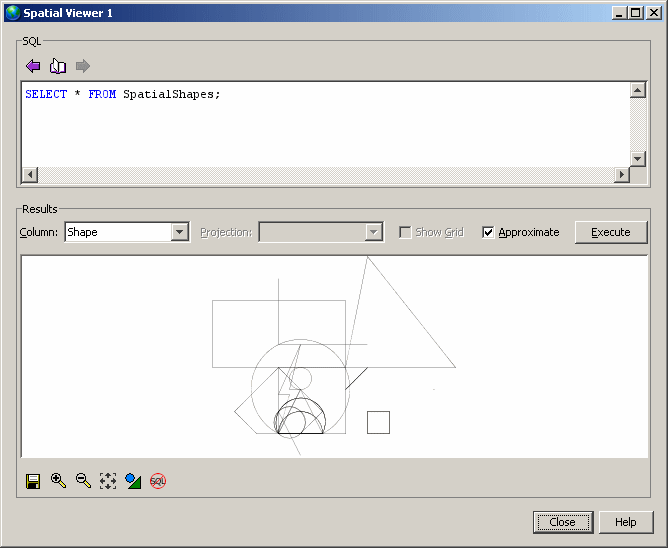
Use the Draw Outlined Polygons tool to remove the coloring from the polygons in a drawing to reveal the outline of all shapes. This tool is located beneath the image, near the controls for saving, zooming, and panning.
Example
Connect to the sample database from Interactive SQL.
Click Tools » Spatial Viewer.
In the Spatial Viewer, execute the following query in the SQL pane:
SELECT * FROM SpatialShapes; |
Here is an example of how the image appears as outlines using the Draw Outlined Polygons tool:
 |
Discuss this page in DocCommentXchange.
|
Copyright © 2012, iAnywhere Solutions, Inc. - SQL Anywhere 12.0.1 |