![]()
![]()
![]()
![]()
You can add spatial data to any table by adding a column that supports spatial data.
Prerequisites
Must be a user with permissions to alter the table.
The table has a primary key defined. Update and delete operations are not supported for tables that contain a spatial column unless a primary key is defined.
Context and remarks
Many.
 Create a spatial column (Sybase Central)
Connect to the database as a user with permissions to alter the table.
Create a new column:
In the left pane, expand the Tables list.
Right-click a table, then click New » Column.
Set the spatial data type:
Right-click the column name, then click Properties.
Click the Data Type tab.
Select Built-in type and choose a spatial data type from the dropdown list.
Select Set spatial reference system and choose a spatial reference system from the dropdown list.
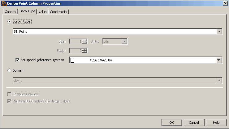
Click OK.
Click File » Save.
See alsoAdding SRID column constraints
 |
Discuss this page in DocCommentXchange.
|
Copyright © 2012, iAnywhere Solutions, Inc. - SQL Anywhere 12.0.1 |